
What We Do
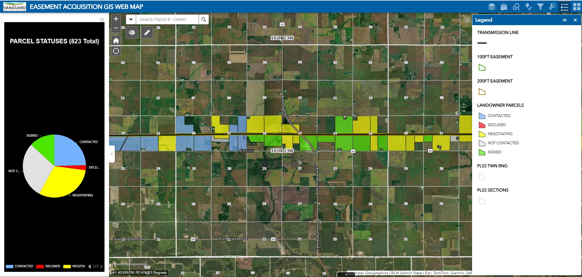
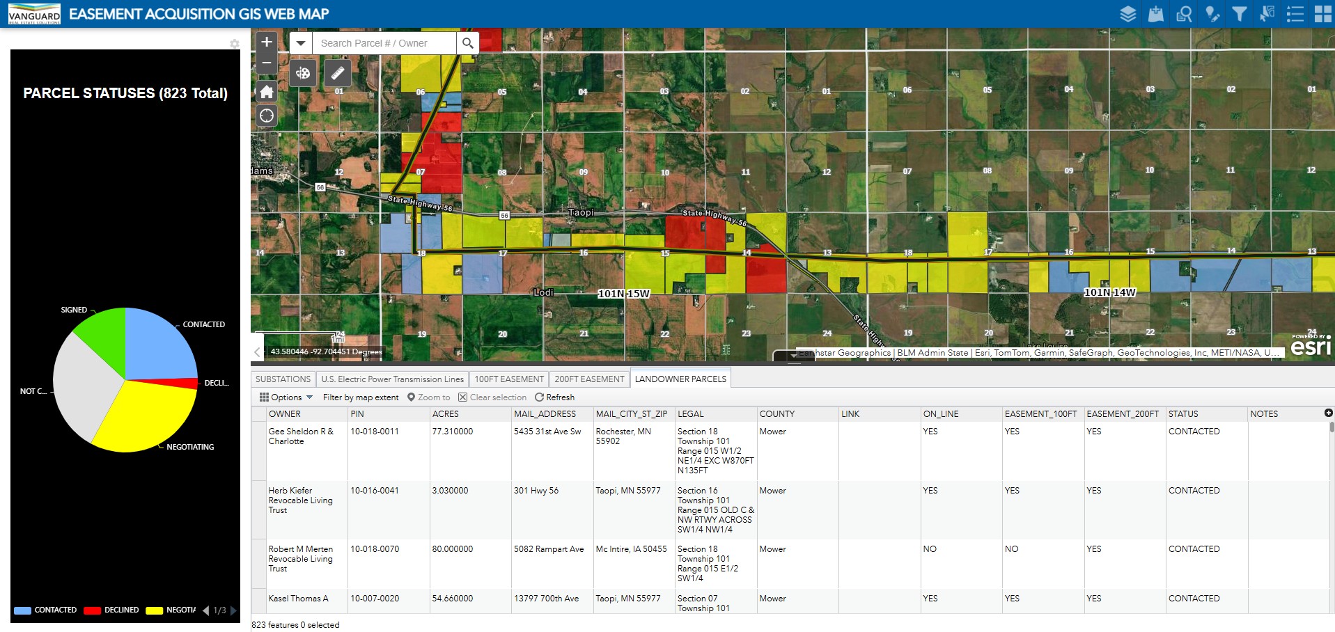
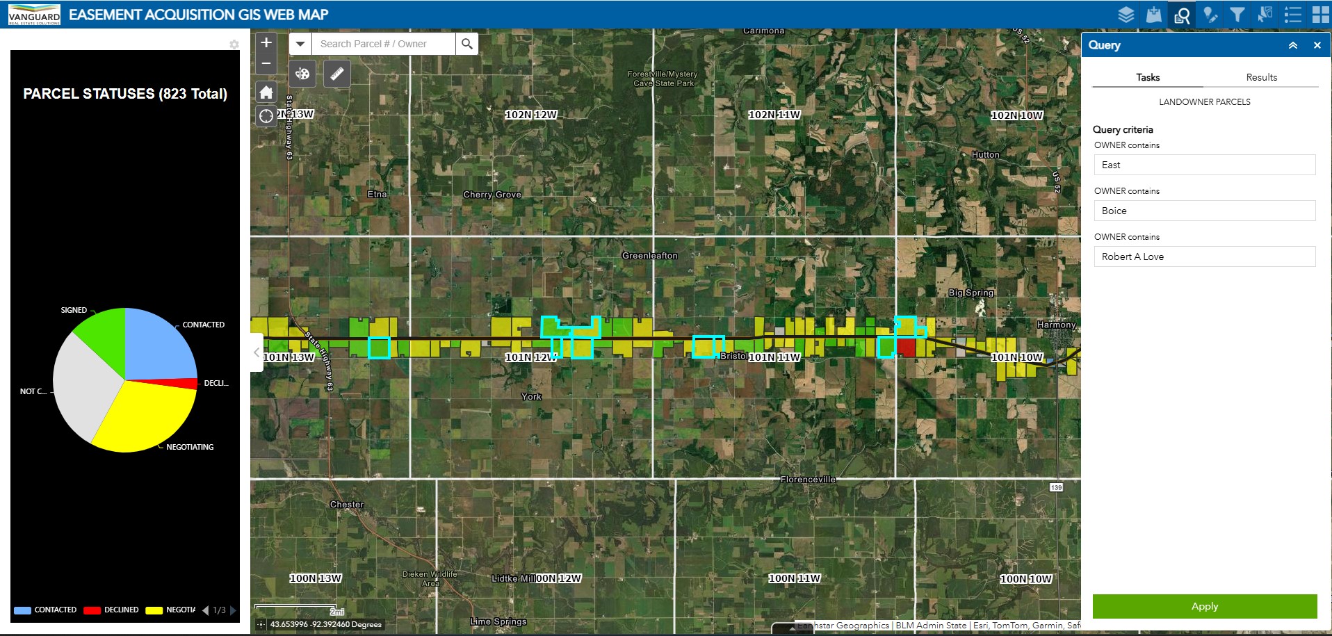
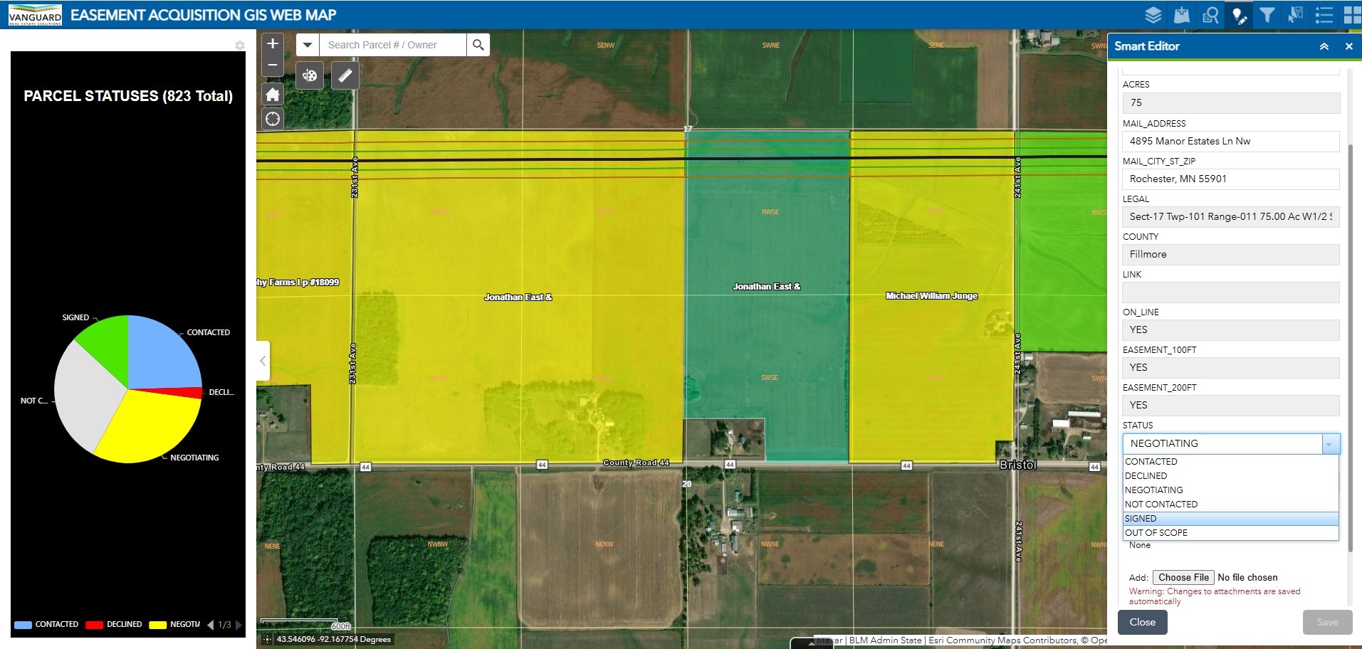
In land development, precision is everything. At Vanguard, our licensed surveyors and GIS specialists turn complex land data into clear, actionable insights. From parcel boundaries and ownership overlays to flood zones and wetlands, we deliver GIS visualizations that support strategic planning and regulatory alignment. By working hand-in-hand with acquisition, title, and compliance teams, our mapping experts ensure every detail fits your project's scope, so you can move forward with confidence.
Ready to Get to Work?
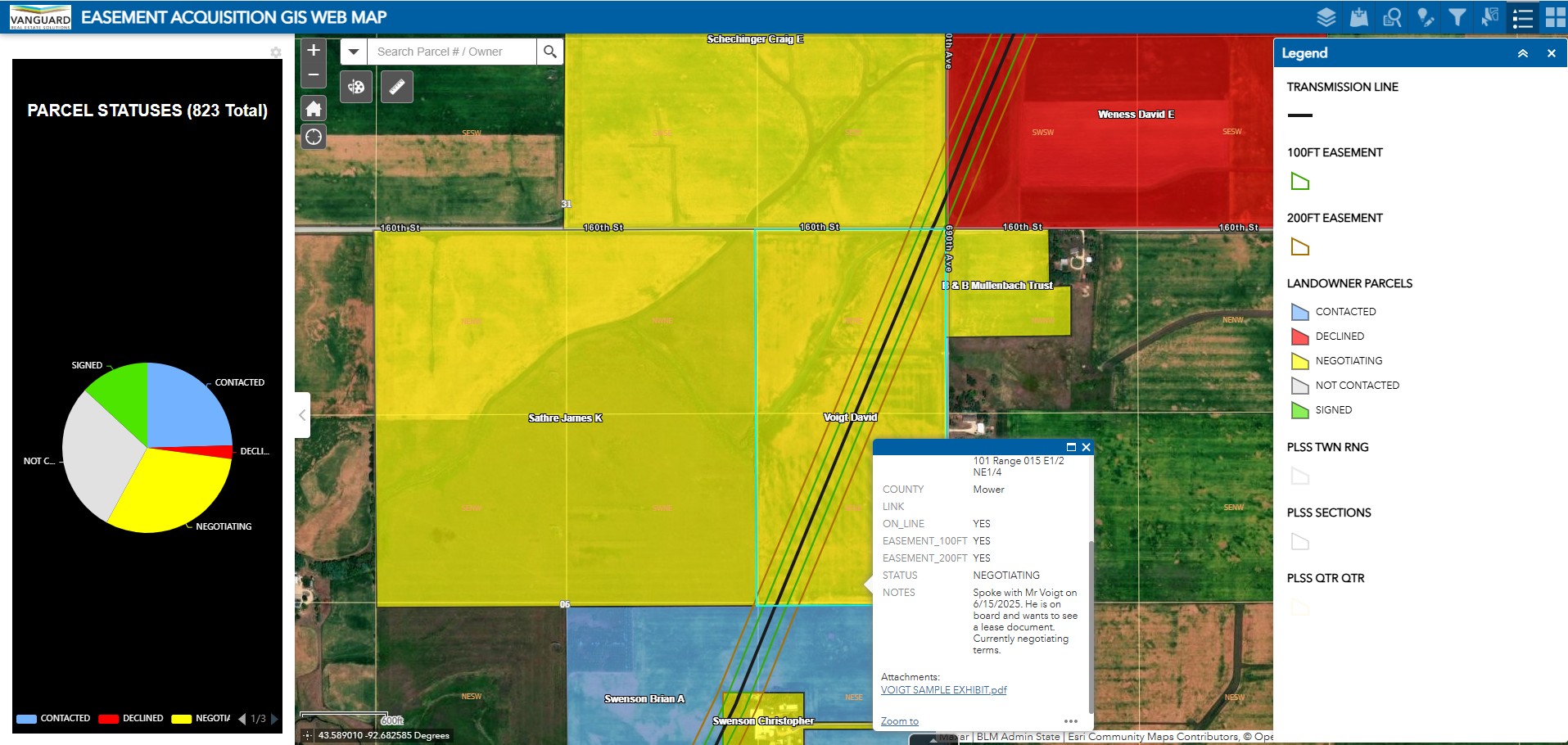
Contact Us TodayWe also offer secure, web-based access to your project's mapping and reporting tools through a customized GIS platform. This interactive viewer can be configured to display survey status, title progress, ROW acquisitions, contact logs, and other essential updates in real-time, so you're always a step ahead.
From early site selection to final project closeout, our maps tell a clear story—supporting landowner transparency, regulatory compliance, and confident decision-making every step of the way.


The accuracy of a survey depends on several factors, including the type of survey, the equipment used, the expertise of the surveyor, and the terrain. Modern surveying techniques, such as GPS and LiDAR, can be very accurate, with some surveys achieving sub-centimeter accuracy. However, older surveys conducted with less advanced technology may be less accurate. It's important to consult with a licensed surveyor to understand the level of accuracy expected for a particular survey.
A survey is a detailed examination and measurement of land to determine its boundaries, features, and legal description. It involves precise measurements and calculations to create a map or plat of the property. An inspection, on the other hand, is a visual assessment of a property or structure to identify potential defects or issues. It typically involves a walk-through of the property by a qualified inspector who notes any visible problems.
A survey focuses on the land itself, including its boundaries, topography, and any existing structures. A structural survey, also known as a building survey, is a more in-depth examination of a specific structure on the land. It involves a detailed assessment of the building's condition, including its foundation, walls, roof, and other structural elements. The purpose of a structural survey is to identify any existing or potential structural problems that may need to be addressed.
The cost of a survey in Texas can vary depending on several factors, including the size and complexity of the property, the type of survey needed, and the location of the property. On average, a basic boundary survey in Texas can cost between $500 and $1,500. However, more complex surveys, such as topographic surveys or ALTA/NSPS land title surveys, can cost several thousand dollars.
In New Jersey, the cost of a land survey can range from $800 to $2,500 or more, depending on the factors mentioned above. It's advisable to get quotes from several licensed surveyors in the area to compare prices and services.
The cost of a property survey in Indiana can vary depending on the size and complexity of the property, as well as the specific type of survey required. A basic boundary survey may cost around $500 to $1,000, while a more comprehensive survey, such as a topographic or ALTA survey, can cost upwards of $2,000.
In Maine, the cost of a land survey can range from $600 to $2,000 or more, depending on the factors discussed earlier. It's a good idea to contact several licensed surveyors in Maine to get accurate quotes for your specific project. Remember, these are just estimated costs, and the actual price of a survey can vary depending on individual circumstances. It's always best to get quotes from multiple surveyors to ensure you're getting a fair price for the services you need.